I am working on an urban research program focused on how people experience movement through Manhattan streets during ordinary daily routines. The current project studies why two addresses that look similarly located on a map can feel different once walking conditions, corridor load, route quality, street access as well as neighborhood connections are measured.
Klosr is the current product name for this city-scale evidence model. The live application remains in limited access while public release prepares; this note and the whitepaper are the public materials now.
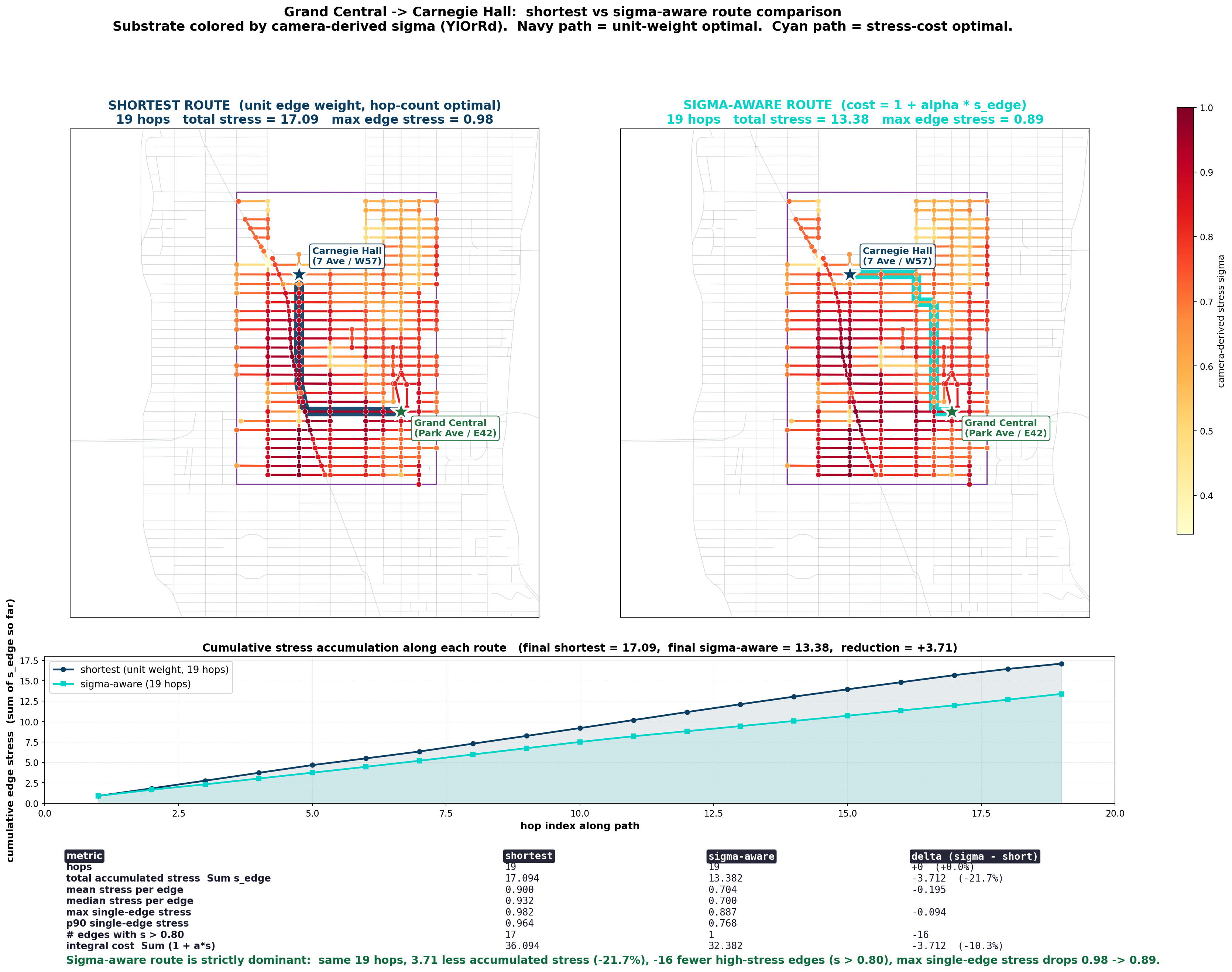
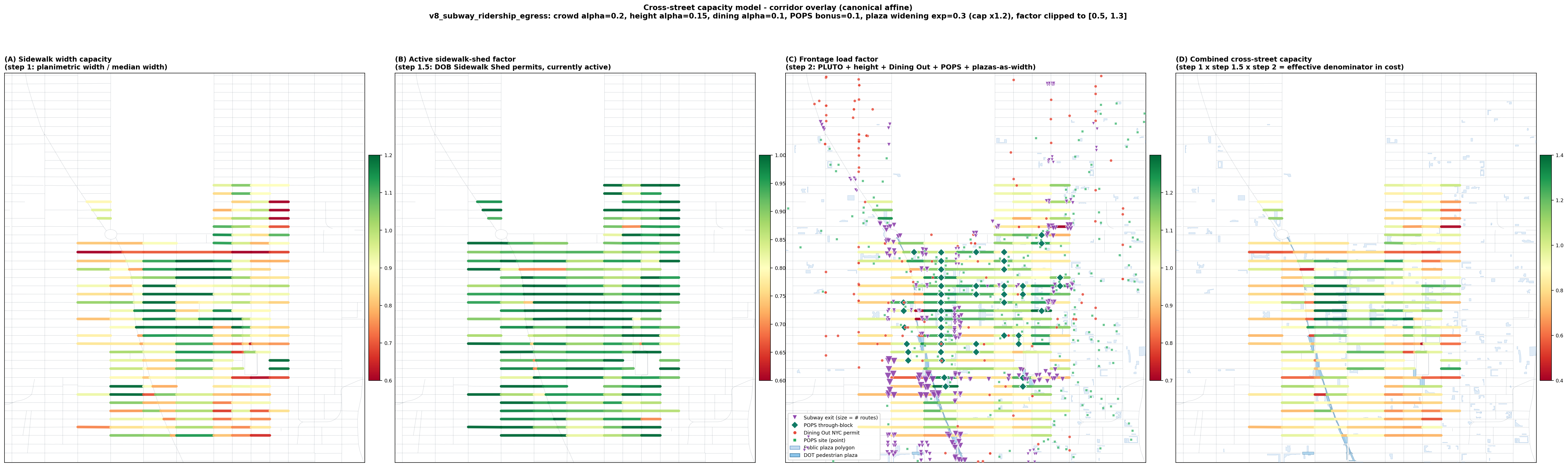
The research studies how stress and constraint accumulate across streets, blocks as well as neighborhood corridors as people move through them. The project looks at how route quality changes with local conditions beyond a simple distance measure and how those conditions shape the practical experience of getting to transit, shops, services, parks as well as daily destinations.
Real estate decisions already depend on more than nominal proximity to a subway stop, park, office, school, store or service corridor. People care about how a walk feels, how exposed or crowded a route becomes, how easily daily errands connect as well as whether a location remains practically convenient over repeated use.
The research is aimed at making those differences more visible and more measurable for future location analysis. A broker or owner already evaluates convenience, access, visibility, circulation as well as neighborhood fit through experience, while this work develops a measured way to describe the same practical judgments.
Manhattan is useful for this work because small differences in street conditions can produce large differences in daily movement through an area. The current baseline is Midtown, where dense transit anchors sit near office corridors, sidewalks affected by active sheds, frontage load as well as pedestrian crowding that make the gap between map distance and lived accessibility visible.
The work is now beginning to expand beyond the Midtown baseline into neighborhoods with a different pedestrian structure. The West Village is the next neighborhood-scale test case because its street geometry, block pattern, corridor texture as well as daily movement conditions differ sharply from Midtown. The contrast helps test how the same method behaves across different urban forms. Being based there would place the next phase of the work closer to the next field site while keeping it near Betaworks, Google, OpenAI as well as the Hudson Square technology corridor as applied neighbors for the project’s next stage.
The longer-term goal is to support practical urban decision tools for people choosing where to live, where to open businesses as well as how to evaluate neighborhood access with more realistic evidence. The work sits close to future location-intelligence tools that compare map distance with lived accessibility, route quality, daily movement as well as neighborhood fit.